There’s Accurate, and Then There’s Skydio X10 Accurate
Ted is the CEO of SkyDeploy, a drone service provider based in Canada. Ted has gained hands-on experience from difficult, drone-based inspections over the past 6 years. Through this work he has uncovered insights about what end users want and pain points data collectors face in the field. He has become an expert in the procedures required for successful analysis and 3D reconstruction of drone collected data. He is also a college professor and teaches these subjects at the post-graduate level. He is currently involved in various academic research projects on the topic and is passionate about the trajectory of this technology.
Explore how the Skydio X10, equipped with RTK/PPK technology, transforms precision in mapping and surveying missions. This session addresses the challenges facing mappers and surveyors and demonstrates how the Skydio X10 solution meets these needs. Attendees will gain insights from a deep dive into the technology, get a preview of results from an upcoming white paper, and join a panel discussion with industry experts.
Thank you all for making it here. Good afternoon, everyone. I'm Francis. I'm a senior product manager here at Skydio, and I work on our high accuracy solutions.
So today, I'm gonna give you a brief overview before we turn it over to the panel, and we'll be talking a bit more about RTK PPK technologies and answer a bunch of questions from you.
So I'm excited to talk about a solution that we'll be bringing to market very soon. And before we dive into it, just a quick show of hands. How many of you are surveyors or you surveying as part of your everyday jobs?
Okay.
I promise I won't pick on anybody.
Quite a few hands, so I feel like I don't really need to preach to the choir here. A lot of you are familiar with these use cases. You understand the importance of being extremely accurate, whether it'd be critical infrastructure or construction of houses or other buildings. You need to be within tolerances, within really tight tolerances. Or even if you're in public safety and trying to collect evidence, you need to make sure that you're as accurate as can be. And oftentimes, that means a tenth of a foot or three centimeters if you use metric.
So today, we'll talk about Scadio Xtend with the RTK PPK attachment. It uses the same technology as the RTK rovers that you have currently. And what that lets you do is get from inaccurate GPS estimates to receiving corrections from a base station or some other correction source and get down to a tenth of a foot accuracy.
And you can do this using a base station, using a course network, using existing infrastructure that you already use, and also take this information and process it using the same tools that you're familiar with today. So use just an attachment. Everything else is stuff that you're already familiar with, and it just fits in your workflow.
We've talked about this before as a concept, but now it's reality. It's here. And if you're a beta customer, you'll get to play with this before the end of this year.
And what can you do with this? There are three primary use cases that we're targeting. So we're looking at monitoring, progress. This is especially useful in construction.
You can estimate volumes very accurately, which helps our construction customers, but as well, but our customers in mining and utilities as well. And then, of course, there's also always the possibility of measuring distances within your reconstructions, and this is especially important for our public safety customers.
So we'll talk about each of these one by one.
First one is monitoring progress. So a lot of our customers today, they actually use Skydio images, and they try to monitor progress by eyeballing it. So you look at images today, and try to figure out if things are in the right place, if things are progressing along. But with the georeferenced accuracy of an RTK solution with georeferenced photogrammetry, what you can do is you can overlay a BIM model.
So you can overlay a construction data and then see if things are according to spec. And once you have this, you can make sure that you're always on track. You can identify mistakes before they become so expensive. And by that, you can save on a lot of costs.
So it's a powerful new way to catch deviations early and help prevent cost overruns. And here you can see some data that Ted here was very gracious to share with us. This is, from Maple in Canada. They're a general contractor construction company. And so they were able to use the X ten and overlay their BIM data and identify these deviations very quickly.
Another capability that's unlocked by RTK is estimating volumetric changes over time, which is important in construction, but also in mining and utilities.
So what this lets you do is you define a boundary, and that gives you a volumetric estimate very quickly. And because the data is so accurate, you can use this for things like verifying how much earth has been moved before you make that payment to your contractor.
In mining and utilities, you can use this to accurately estimate your stockpile volumes, and that helps you with future planning and order.
So lots of different things that you can do with this to improve your workflows in general.
And the same solution can also be used in a bunch of other use cases. So we've heard about beach nourishment immediately after a hurricane. That's a pretty interesting use case. And you can also do avalanche monitoring with this sort of stuff when you can estimate snow volumes.
And last but not least, measuring distances.
This is very important for our public safety customers who want to get a very accurate reconstruction of an accident scene. They want to collect all of this data, make sure that the total station data that they collect over can be overlaid perfectly on all of this, and it can actually be presented to a court as evidence. And so accidents are always unfortunate, but people still, they're tasked with reconstructing the scene as quickly as possible and getting this out of the way so traffic can continue flowing, in order to let people keep moving and to make sure that there are no more subsequent accidents. And so Skydio x ten will be able to help with this.
So what makes all of this possible? We've got best in class sensors for all of your missions. We've got industry leading rolling shutter correction. Try saying that three times.
So this is something that we're really proud of and is something that differentiates us from the rest of the industry. With the VT three hundred l sensor that we have on there, despite the lack of a mechanical shutter, we're able to achieve highly accurate reconstructions through this rolling shutter correction. And lastly, we're partnering with the providers of a lot of powerful software. Some of them are here today.
So, you'll hear later from James from DroneDeploy. We're integrating with TBC. We're integrating with Pix four d. So we have a lot of partnerships that are ongoing with these companies to make sure that our new camera models, the way we do rolling shutter corrections, all of these are accounted for.
So you don't have to take any extra steps to get from data collection to the actual insights that you care about.
And for the first time today, we're gonna show you the results of some of the internal testing that we did with our rolling shutter correction. So this is just looking at horizontal RMS errors, and you see the orange bars that are before we applied rolling shutter correction. So we collected this data. The same rolling shutter correction that runs onboard on our drone was then applied in post processing.
And you're able to see that even without any GCPs, this is with checkpoints only. We got really, really close to three centimeters in almost all of our cases. And that gave us a confidence to go ahead and build a solution. And you can see the same thing on the vertical axis as well.
Again, orange before applying rolling shutter correction, blue is after, and that green line over there is the target. And this is all results from very early in the development cycle. So we've actually made a lot of changes since then, and our results today are gonna be a lot better.
And beyond that, it integrates with the tools that you already use. So we talked about drone deploy, PIX four d, TBC, Bentley. And there are a lot more that are not included on this list. And then we are also compatible with a bunch of correction, sources.
So you have your own base stations that you can bring. You can bring a trim trimble. You can bring your MLID. And then you can you can also correct, connect to cars networks.
You can connect to correction services out there. So point one or a SWFNAV or hexagon smart net. So a lot of these have already been validated, and we're continuing to validate a whole ecosystem of a bunch of different tools that you could be using today.
And you can also see some more data that we collected over the last few weeks. So this is data that was collected by a customer. This is Iowa, so they were using the Iowa State Plane coordinate system. And so you have this reconstruction that they did in Gnext.
And these customers, they primarily use PIX four d and, Esri. So they were also able to provide accuracy targets, accuracy validation here. So you can see the RMS values of the x, y, and z separately, and that green chart over there is that three centimeter target. They used a bunch of GCPs for this, but we've also done a lot of tests without any GCPs.
This is another zoomed in version of the same thing.
And as I hand over to the panel so everybody can get seated here, you if you wanna take a look, you can pull out your phones now. You can scan these QR codes and look at these three d models on your phones by yourselves.
Yeah. Thank you.
Great. Well, thank you, Francis, for that awesome presentation.
Before we go to the panel, just some quick intros. I'm happy to to start, so I'm the moderator for this panel. My name is Gagan Khanwar. I lead tech partnerships at Skydio.
Very excited to be here with all of you talking about high accuracy measurements using Skydio extends, and also, you know, a lot of the partners that we're referencing here are people that I work with directly and and, again, excited to also have that opportunity to have them on the stage with us.
So with that said, I will hand it off to Aaron for intros, and let's keep maybe going on the line.
Sure. Aaron Chamberlain, California Department of Transportation. You drove through our road work on the way here. All that work is being done by our division.
So we, Cal Cal Caltrans is twenty three thousand employees. We have fourteen billion dollars under construction currently, about twenty three hundred projects. So I believe we're the largest. Texas is gonna be get bit mad at me if I say that, but we're the largest DOT in the in the country right now.
So a lot of work going on out there.
My name is James Pipe. I run the product and design teams at Train to Play. I've been at Train to Play for the last eight years, and, we work across many different industries.
And I'm excited to speak about high accuracy data today. It's very important to all of our customers.
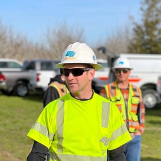
I'm Ted.
I'm from Canada, and I bought my first drone in twenty seventeen, and I've just been using it for services. So I I own a small company, and, typically, you can find me out in the field collecting data, and I'm also a huge photogrammetry nerd. So somehow I find myself on the stage talking to you guys about that as well.
I'm Francis. I'm a senior product manager here at Skydio, and I lead our RTK solution on the product side.
Great. Well, thank you. So, the first question, and the way we'll do this is we have, questions for all the panelists. We have questions for specific panelists, and then we'll have audience questions as well. So this first question is really for all of our panelists, and it's basically what what are the big problems that are out there for high accuracy, and how do you see PPK and RTK helping address those problems, broadly for the industry? And then what are the implications of that for the kind of stuff you're doing individually with your customers or, for for your business?
Who's going first? Me?
Actually, why don't we start start with Ted?
Sure.
I think one of the biggest bottlenecks is just understanding all of the concepts that go into getting accuracy out of photos.
It's not a perfect science. It's a mixture of art and science. And a lot of these blunders can happen very easily. They can happen in the field and they're not really recoverable afterwards. So, it takes time and it takes quite a bit of, you know, trial and error to figure it out. And I think that's one of those things that we can talk about accuracy, but really that accuracy happens out in the field and it happens in an office with a human in front of a screen doing a lot of clicking. And all of those things have to work together very well, for it to happen consistently.
I'll start with one word, and that's datums.
Knowing which datum has been used to collect the data and which datum you're gonna be using that data in is the biggest problem. And the second is trust. And it can I trust this data? Especially if the data's already been processed and you're downstream of it. You know, is this actually good data? Can I make a measurement?
There are you know, it's extremely difficult to qualify as a professional surveyor in the US for good reason. It's a very hard problem, and it's something that, through a bunch of new technology, I'm very excited to see becoming easier and easier to to solve.
Sure. I would say, well, adding to both of those, I would actually say the standardization piece. Right? So we have really good ASPRS standards.
Anybody familiar with what I'm talking about? Or am I just throwing out random acronyms? Yes? Not hand not not if you're not if you're here.
Okay. So we got ASPRS standards. Right? But they don't necessarily work great for highway construction, particularly linear corridors.
Not great. Right? So, one thing that actually California and Alaska DOT are gonna be leading an effort on is a pooled fund study, for, structure for motion photogrammetry standards, for bridge inspection standards, basically, at the gamut of all across the board for, at least in our industry, for highway based standards, so that we can actually have a base product of, okay, what do I need for construction inspection? Do I need two centimeter accuracy?
Do I need four centimeter, for a bridge if I'm doing bridges? Right? So ASPRS standards are great for an eight year imagery. What do I do when it comes to a bridge?
K. How many how many GCPs do I need on the Bay Bridge, to be able to recreate an active model?
Nobody really knows the answer to that question. So we're hoping to be able to tackle some of that stuff with that pooled fund. So that's gonna be starting here in about three or four months, and it's gonna take about five years. But we do have, assurances from Federal Highway Administration that they're gonna be backing our, our our results from that pooled fund study.
Cool.
Yeah. I agree with what most of the panelists here have said. I think it is ultimately a very complex workflow, and you throw a drone in there. You're capturing something from four hundred feet up in the air, three hundred feet up in the air.
You have the precision of an RTK up there, but even like a zero point five percent change in your focal length that you don't account for, that means your models are gonna be completely inaccurate. So that's the level of precision in engineering that's needed. And then there is a whole, a very big role of GIS expertise as well. So like you mentioned, having a bunch of different datums, knowing what datum you were receiving corrections in, what datum you're processing everything in, and doing all of that and having the knowledge to do all of that in the right way is also something that you need to make sure you have there before you can trust those results.
And that's actually a a good segue for for the next question, Francis, which is which is also for you. Mhmm.
Can you walk us through the development of Skydio Xtens RTK and PPK module, but also the the technology more broadly.
And what were some of the key considerations for you as you were working with the engineering team and our customers to build those capabilities?
So like the title of this talk, it's about accuracy, but zooming out, it's about a lot more than that. One of the first things that we did when we were developing the solution was go out and spend time with customers to see how we were doing these things. And one visit was in fact with Aaron here. And despite how charming and insightful you can be, the best payer part of that day was getting back in the car and not having to deal with a hundred fifteen degree heat and no shade. Hey. That's life. And so I think California.
Even for the most sturdy and outdoorsy, people in this room, I think if you were given the chance to simplify this process and spend your time doing other more valuable things instead of just collecting data, you would take it. And so that's been the guiding principle for us developing this product. And thinking of the considerations, I guess there are three key ways that we can do this. The first is making sure that your flight setup is super easy, and the actual flight itself is super easy. So this involves bringing in your project data, bringing in your construction data so you can plan despite the inaccuracies of whatever map layer may be present.
The second is making sure that you're not making mistakes out there in the field or when you are making mistakes. Those are super obvious. So even with the beta product, we do things like fetching and prepopulating a mod point list. So where if a single spelling mistake isn't ruining your whole day that day. We try to make it very obvious when your connection drops or something else until what happens. You can see distances to base stations and things like that.
And the last piece is, of course, integration. You have to take all of this and you have to pass it through powerful engines like a drone deploy or a TPC to get those results. And Gagan and his team have been very fundamental in helping us achieve that and establishing these partnerships to make those workflows easy.
And that's just scratching the surface with beta. Beyond beta, there are other obvious things. We will have RTK solutions that are working on remote flight deck on the Xtend dock. And so there are, we know not all of your terrains are gonna be flat, so there's gonna be terrain following, corridor capture, all sorts of new features that we will be building to make this whole process easier.
That's that's, super interesting.
Next question for Ted. Ted, having had early access to the RTK and PPK attachment.
Could you share kind of your testing process, and what results you saw, with that?
And then how did this sort of early access influence your approach to precision mapping, and and what were your key findings there?
Yeah. Well, when I first saw x ten, I think it was almost a year ago, I I I was already a Skydio user. And if you followed my story on LinkedIn, I post a a lot of videos. You could you can kinda see the progression of that and where I use Skydio, vehicles.
There's specific use cases that I was putting the s two plus in that no other drone could manage, inspections specifically. And by the fact that it was completely able to function in a completely GNSS denied environment, like under a bridge. When I saw x ten, there we had, an an evolution of that, but then we also saw, attachments.
And my mind, when I saw the RTK attachment, it first went to holy cow, three d scan with RTK or PPK. That's that's what I'm looking forward to, and that's what I wanted to test right away. But then there's also mapping because now this drone that I had previously, the s two, where I would I would put that in the situations that it did really well in, but I would maybe use another drone, for mapping scenarios. The x ten, I can use across the board.
And so it's become really a multi tool. And throughout my testing, that's that's the type of environments I'll put it through. I made a little video because I like to let the data kind of speak for itself. So we'll play that now.
Alright. So this was a building that I scan every year for the city I live in.
And this year, I did it with the X ten. And past three years, I've done it with s two. So I was able to PBK correct all the image positions. And this is what I'm talking about, having accurate priors or known positions before reconstruction gets you this. This was twenty two thousand images.
It took about two days.
And then that camera was the next thing I was really excited about, the resolution bump.
So you can see that play out.
The other thing is having thermal there always capturing plus RTK. Let's you do this. Combine a three d model from the RGB, really detailed, but then you can texture that with thermal information.
I put the x ten through, a lot of different situations. I'm in Canada, so we see some interesting weather sometimes.
Wind, dust.
See here an example of volumetrics. I say something pretty provocative here. GCP free volumes. Aaron might not agree with that, but This is a runway.
And, I've done a project like this before with an m three hundred. And the one thing is that the X ten can fly really, really low and map. And, other drones are typically limited by that minimum altitude. So I was able to get two millimeters on one battery.
Makes this very feasible for larger scale inspections of this type. And it may not always be a runway, but it's there. And then the rolling shutter correction. This is just PPK images on ground control.
And you can see that error that that blue circle is where the GPS position is.
So you can see how far off we are and we can see the error to GCP position here is about a centimeter horizontal and three vertical, three to four vertical. Now that's GPS accuracy. You're not gonna get better with your receiver anyways.
But I've also put a x ten through other situations, situations that are not RTK dependent. But, again, it's that multi tool aspect of it. That thermal camera, I love, and I love that it's just there. That's that's one of the biggest bonuses.
And, of course, photogrammetry and three d scans, why not do them indoors because you can?
And why not throw it into drone deploy because then I don't have to process it and spend any time?
And you can see that the results are fantastic.
Another more confined space, indoor three d capture here as a time lapse And another drone deploy reconstruction, really great textures. And again, that was about, ten minutes of flying very, very quick, four hundred photos.
I love demoing the x ten when I'm around my friends. That's Adam.
That was a booyah. And, this was kind of interesting. This was actually Sunday before I came here, and, I had some lidar GCP targets. They're a little interesting, but I couldn't find them.
I didn't wanna pull out the receiver to go and find the points and then track it down. So I actually used x ten with a night sense on. And I would spot them in the air and then just let it hover over, and then I'd drive my truck over to that beacon. And it was also my work light when I needed to pull it out of the ground and put it back in the truck.
So multi tool.
But, yeah, I think that sums it up pretty well.
Testing is still going because there's so much to test. And that's the beauty of of of photogrammetry and just working with the data. We don't really know everything that we can do with it yet, and use cases are popping up all the time.
Thank you, Ted.
Next question is for James.
James, how does the precision offered by RTK PPK help, drone deploy offer more capabilities or better outcomes to customers?
Well, I was worried I was gonna have to sell drone deploy, but thankfully, I've got a team.
So, I'll give you three examples. So one is, so DPR construction, one of the largest GCs in the US, they have spun up quite recently an as built in, workflow for underground utilities.
Scary stat, once every minute in the US, a construction crew hits an underground utility. It costs thirty billion dollars and, four hundred people die every year because of it.
It's a huge problem. And the worst part is, often it's the same contractor who buried the thing that then hits it. Right? And that's obviously also very embarrassing. It stops work on job sites, it causes, huge problems for critical infrastructure. So that's, you know, one workflow is just fly the drone all the time. Every time you're digging trenches, every time you're laying underground utilities, capture where they are, And the accuracy you're you're gonna get from a drone like Skydio X ten with RTK or or PPK is exactly what you need for that problem.
Really, really awesome workflow. They have a digital dig board, so that every anytime anyone's gonna dig, they first check the digital dig board, which is just drone deploy, and they can see their designs in there as well. And actually if, you press play on, the video I've got here, you can see the other thing we can do is once those underground utilities have been modeled in the as built position, you can import those into DroneDeploy as well and then just visualize them by making the ground transparent. And you can visualize them in three d, so you can see how far below the surface they are and measure that as well.
Second piece is comparison to design.
So, again, you can just pull in, visualize your data in the in the format, that you use and as a result you can see peers underground. You can see the, actual infrastructure itself. You can see what you're about to build. And you can have a look and see if things have been built in the right place.
You saw it earlier with a two d example of here's an overlay, but you can also do that in three d. Again, the key point here is everything needs to be in the same datum. Every everything that you're ingesting you need to know how it was measured, but then you can get these fantastic results. And then the third thing is topographic mapping and comparison over time.
So measuring volumes change over time, measuring the amount of materials you're importing or exporting, from from a job site as well, and, ultimately signing, pay pay applications as a result of that that that data.
Thank you, James. Next question is for Aaron. So Aaron, from a transportation engineering perspective, how does the precision offered by RTK and DPK, offered by RTK and PPK, impact large scale infrastructure projects? And could you share some examples of, like, how you would use those in in real life?
I shoulda had a video. Apparently, I missed that memo, guys. What the heck?
So I don't have a fancy visual for this, but, anyway, we'll talk you through it. Yeah. So, anyway, big infrastructure going on out here. I mean, you all drove through our work zone.
Right? How fun was that? And then two o'clock in the morning, it was still busy because they were out there paving. I I know because I came in at two AM last night.
Anyway, all this stuff that's happening out here is really important because we're spending billions of dollars, right, of how many of y'all live in California?
So that's all your money. Right? You're paying those taxes. You want us to be, expending it properly. You want us to know where that stuff is, where all these utility lines are, where all are our culverts.
Right now, Caltrans is embarking on this big, kind of a bigger vision of, of anybody familiar with the term BIM, building information modeling? Came out of Stanford.
Previous to that, it was called BDC. Federal Highway Administration decided to call it BIM for I. So now we got a bunch of acronyms that all mean the same thing. Anyway, none of that process works. Right? I'll BIM the big BIM push, right, is all involved in three d modeling, three d modeling, lots of attributes.
We can't get to that level if we can't do the reality capture piece correctly. So that's fundamental to all of this whole BIM world working, is the reality capture data and the modeling capture data all come together in one interface. So we can actually, you know, now start to apply things like machine learning.
We're still, I would say, really early in this process, but we're starting to see a lot of success with, you know, not yet not necessarily photogrammetry yet, but some of our lidar products being able to do auto feature extraction and then auto comparison.
I think that those technologies are gonna come very rapidly to some of the structure for motion photogrammetry products as well, where we can start to do automated inspections. So I don't have to send three guys that I can't afford to pay anymore. I mean, right now, anybody any of our engineers in California, you want a job? We have seventeen hundred vacancies.
So it's it's not a great time to be in our industry because we just can't get people to do things. So to be able to automate a lot of this is really gonna be critical. That's why we're looking so forward to things like dock. So we have three dock systems of the older generation currently used right now on active construction projects in right now.
So there's one in Northern California, one in Ventura County, and one in San Diego. All those things are out collecting data on nearly a daily basis. But adding that PPK element to that is what's going to help us, again, build those digital LAS builds and start to to function for trying to alleviate some of those manual workflows that we have historically had that are, in some cases, still I don't want to say this, but some of them are still paper based or at least PDF. Alright.
Those are a lot of these manual workflows that we're doing. So, really, this is going to take it from this, I still say paper based workflows or these form based workflows into a complete digital workflow where drone can go fly our job site, give me a report. Hey. At the end of the week, hey.
We moved twenty six thousand yards of dirt. Now I have a paper trail that goes without when I'm paying our contractor six hundred thousand dollars and they have a dispute and say, oh, you owe me seven hundred thousand. K. Well, let's, you know, let's go to the referee.
Here's the data. You know, I'll give you the data. This is what's you know, we're we're not gonna have these arguments anymore. And frankly, those are a big component of what we do.
I think Caltrans pays out about half a billion dollars in in construction claims every year, between change orders and claims. So if we can reduce that even by fifty percent, you know, we're saving the taxpayers a lot of money by using technology.
That's that's really interesting.
So I think this we're coming up to the last question here, and this one's again for for all panelists. So I'll start with with you on this, Francis.
Looking ahead, where do you see the future of RTK PPK technology, and what advancements or innovations are you most excited about? And, actually, before you answer that, I think it might be helpful if we could just clarify for the audience quickly what is the difference between PPK and RTK, and also, like, what are the use cases for PPK versus RTK? Mhmm.
Yeah. So the primary difference between RTK, which is real time kinematic, and PPK, which is post process kinematic, is, the real time aspect of it. So if you're using RTK, you're receiving those corrections in real time from a base station or some other correction source. Whereas with PPK, you're collecting all of that data on the correction source and then processing it later to try and achieve the same accuracy.
So with these technologies, there is a big ecosystem of different players that are coming in and helping make this industry a little bit easier for people to understand and work with. So in general, there is this trend of the industry moving towards an easy button of sorts where you can just collect this data, put it in something, press a button, and presto. You have results you can trust. Right?
We are not quite at that stage there. So what I'm most excited about is extremely talented folks from a bunch of different companies coming together to make that a reality. And, you can see drone deployers already doing this, for example, with some of their integrations today where you don't even need to go and do any sort of setup. We have they they have partnerships with a comp with, providers that let you get RTK corrections without having to enter any credentials at all.
So that is a future that I'm personally excited about. And if we have something similar, that we can build and then bring to the market, which ultimately helps bring down my taxes in California, I'd be very happy about that.
I'll do my best.
Ted, you wanna go next?
The one thing that I've been keeping an eye on I'm really excited about is this notion or this concept of decentralized physical infrastructure.
Accurate positioning is very important today. It's only gonna become more and more important as more devices, vehicles, etcetera, rely on it.
And PPK and RTK, while they're great, they still depend on the source of corrections. And for a long time, that source of corrections has been a monopoly, maybe duopoly. It's it's it's a little bit too centralized.
What what's sort of emerging is this concept, and I think it's probably the only use case of crypto that I've seen that I can get behind and understand the value behind it, is, is sort of these corrections networks hosted by individuals.
For example, I run a base at my home. It's just on my roof and, all it is an antenna and a box, in my basement.
But every hour that that base is collecting information and making it available for the network, I'm earning some coins. And I can use those coins when I'm somewhere else and I need to use someone else's base station for corrections. And this leads to sort of an incentive to just spread these bases because we need them. There's no other way to really get these corrections, You need to have observations.
And, and as a business owner, one of the biggest pain points has been the cost of these subscriptions to get the corrections from. So we need more, corrections, sources.
And I think this is exciting because there's an actual incentive for everyday people, to set this up and then, you know, enter that that network.
I also have a GeoDNet box running on my roof. Oh, different decentralized network. Fight. Okay.
So for me, I I look at I look at the challenge here as an engineering challenge.
I whilst it is incredibly difficult and historically has been incredibly difficult to get reliable high accuracy results every single time, that is an engineering problem, that is not inherent in, physical reality. And, we have made huge strides both through, as as you were discussing, an automatic connection to a known datum RTK network.
We also do that with PPK. So if you drag and drop data into drone deploy, it has PPK, observations alongside it. We will process that data for you completely automatically to a known datum that we know, so that we can, compare it either to RTK data or to GCP data that you brought in.
The huge benefit here is that you shouldn't need to know exactly how to design and build a car to drive a car and get value from that car.
You should be able to collect, process, and use high accuracy data without needing to understand all of the technologies that we use to generate that high accuracy data. And for us, really, this is about having thousands of people being able to benefit from the high precision information and and making it very, very simple. So that's the future I see is drag and drop simplicity throughout all the value chain in this in this area.
Alright. I guess I'm next or last, whatever you wanna say it. I I was gonna say that the thing that I'm actually most looking forward to is not just RTK PPK, but actually the integration of that with dock based UAS.
I think that's what what's gonna fundamentally allow us to actually start to leverage our technology better. You know, when I can have dock based UAS systems sitting out on a job site completely autonomous, they're solar powered, they're backhauled with Starlink or four g or five g backhaul.
I can preprogram missions into those systems and say, okay. Well, again, this is future state. I can't do this because of the FAA right now.
I wish I could. At least right now, I can monitor it manually. But, yeah, anyway, the ability to do those remote missions over and over and over again without having to have a physical person there. I mean, we have projects all over the state. We have parts of remote portions of the state that, believe it or not, there's two hours where you can drive and not have a cell phone service. So for staff to be able to have to drive all the way out there to be able to do maybe a very basic routine inspection and drive all the way home, That entire way, they're they're emitting carbon in their vehicle unless they're driving a Tesla or something, which we're in the process of doing that too, but that's a whole another story.
Anyway, back to the dock thing. Yeah. So these remote docks, having those out on job sites, being able to do these repeat operations over and over and over again, where potentially we can back off, on the physical inspection piece that I can't seem to fill those vacancies for anyway now. So we can actually still get the same level of quality that we expect out of our contractors to be producing and not have the physical staff there.
That I think is really the big game changer. Because if we can do that, again, tied with dock based, you know, the autonomy piece and then the repeatability piece with PPK RTK, you know, now we can actually do these, you know, forty, five d simulations of how as that contract was built over time. And if we do get a contract claim, you know, six months after the fact that the contractor comes back and says, oh, you guys owe us another million dollars for, you know, name your made up thing. Right?
Okay. Let's go back and we could rewind the project. We can we can redigitally build that thing as it happened.
So that's like I said, I think that's the thing I'm most excited about.
That was that was great. And I think that sort of, like, brings us to the the part of the discussion where we open it up to the audience. I did have one final question because I've heard this theme a little bit from you guys. It sounds like where a lot of this is going is that we're gonna be creating digital twins for all kinds of different infrastructure. And in order to do that, we need drag and drop, pretty easy to use, high accuracy solutions.
We need more robotics and remote operations so that we don't have to hire seventeen thousand people or fill those fill those roles necessarily in your case to be able to do that. And then the last piece is really just some consistency around datums and the overall coordinate system that you're operating in so that you're making sure that you have alignment across those those datasets you're collecting.
So it's really exciting for me to see all these things. Hopefully, we'll get to that future in the next five or so years.
But with that, let's open it up to the audience and see if anyone has any questions.
I see a hand over there.
Hi there. It's, Jamie from Dwacker Mining Services. So just listening to our utility discussion this morning, but we're a mining technology platform in Africa.
We challenged and I I know Ted because I watched some of those videos online. But, under roof mapping, obviously, it's not RTK because we're not gonna have the signal, but moving into and out of these zones is probably something that we we would like. Maybe just some comments from people that are doing that. I think that's quite a unique thing to be able to do GPS tonight and then back in.
Again, coming back to the camera, this this is probably the next discussion.
Yeah. I can take that one.
Skydio fundamentally started as a vision based company. When we first launched our product, our navigation was VPS based, visual positioning system based. A lot of the stuff that we do today in battlefields don't actually rely on GPS. So a core part of our history of our engineering talent has actually been focused around really accurate reconstructions without any of the these external sources. So while you don't get the accuracy of an RTK solution indoors, I think we are pretty well positioned, and we are currently improving the photogrammetry engine that we have in order to get better and better precision. So we are always striving to improve the accuracy of our reconstructions regardless of what the sources are. It's just a little bit harder when you don't have an RTK correction source.
Yeah. Question here.
Just just an additional thing that you cap you could also tie in internally surveyed targets, in into the into the situation.
Yeah. Hey. Hey, guys. Gary Chapman here with Turner Construction.
You know, I think we all heard, and you guys mentioned how critical accurate data will touch, you know, an array of industries, whether it's, you know, commercial, you know, construction, safety, every everyone. It really opens the doors for everything that we're talking about this conference to kinda take it to the next level. So my question is, you know, specifically for, you know, Skydio and DroneDeploy.
How much are you guys investing in accurate data, within your companies, like, this upcoming year? How much have you invested last year? And what's your trend do you see, how much you invest in your engineering in your engineer's time to make this, you know, come to market faster? Right? RTK is kinda what the industry is waiting for with specifically the x ten. So, you know, I know everyone here is anxious to use that. So if it's so important and it changes everything, it makes everything better and possible, why are we not seeing it earlier?
I'll start. It's extremely hard, is the first problem. And, actually, we're working super closely with Skydio. Got Skydio team along the front here who are doing a bunch of hard math, to make sure that this stuff's really good. I think that the challenge is you don't if you release something too early in this space, you can lose credibility so quickly. And so you can see the diligence that the team has here, that they're trying to get to an awesome level so that when they hand it over to you, it's it's really, really good.
From our perspective in terms of investment, it's one of, like, two core pillars of of drone deploy, hierarchy aerial survey and then, more and more high accuracy ground, capture and and survey as well and merge fusing those two pieces together. It's gonna continue to be one of the most valuable things, and, actually, we've seen in the last year a three x increase in the amount of high accuracy data being uploaded to drone deploy. In construction, we're now about thirty five percent of maps are controlled either through RTK, PPK, or GCPs or a combination of of those.
And that question was more more to Skydio. Right? Not a drum pull.
You guys are heavy with accuracy.
So I'd love to hear what Skydio is is looking to invest their engineering group on making that, more available in a in a quicker, more rapid pace than than than what it's been historically. Yeah. Not not sure.
Critical, but just you know?
No. It's it's a new space for us. Skydio has not typically operated in the high precision market. Entering this whole DOT construction industry is pretty new for us.
So we are hoping to learn a lot more from you guys, and that's part of the reason why even with the alph RTK Alpha, we actually came out to a bunch of construction companies, trying to see what are all of the differences they have in the ways that they operate. And just the surface area there is extremely large. So that is something that we have to account for. And while accounting for that surface area and trying to hit that extremely high accuracy metric every single time.
That has taken us a little bit longer than we had originally anticipated, but the engineering team is extremely well well funded. So we actually had a review, not that long ago, and we put decided to pull more resources in to make sure that we're able to get this to market as quickly as possible. And that's kind of why I have the confidence to say it today that we plan to have this before the end of this year.
Awesome. Thank you.
Any final questions? Alright.
Before I begin to speak of, moving beyond RTK, what do you guys have do you guys have any thoughts on quantum GPS?
Because there's been kind of a a rise in that technology and and submillimeter accuracy, that's kind of looming probably more than five years in the future. But what are some thoughts around that?
I don't.
Those receivers sound expensive.
Whenever as it gets into, like, this this measurement of accuracy, we have to remember that you either apply that to all situations or just few, you know, a few select kinds.
Most of the time, the hardest thing is just making sure you can compare what you've generated to a known point, and and is that point accurate or not? This this is a reoccurring theme whenever we get into high accuracy, drone stuff. And, there there isn't many situations, I think, when you're using a drone except, I guess, in my experience, that the precision that we see from laser scanners or total stations is really necessary.
I think the drone is a tool, but those tools will those other tools will continue to exist, and it may not be GPS today or in the future.
And I don't think those tools are gonna go anywhere anytime soon either. And Aaron uses a lot of lidar. I've been using a lot of lidar myself. And again, like, there's situations where you're gonna use lidar, you're gonna use GPS, you're gonna use a drone.
It it really varies by the the use case, I guess, or the data.
And say I'll add to that. Yeah. I mean, we're we're not, you know, we're not using, we're not viewing drones as the end all be all. It's one more tool in our toolkit.
We're still doing you know, if you're doing cadastral land work, you're doing that with a total station, you're doing that with RTK, and you're doing static sessions. Right? Because that's the level of accuracy you need. It's about, again, it's about the standardization piece, knowing what the need is, what is the level of accuracy needed, and achieving that and no more.
Because if you're doing anything more than that, you're actually wasting effort. So then back to the efficiency piece. If I don't need millimeter accuracy on, you know, midway through a project earthwork, why am I gonna spend the effort to do that?
Great. Well, thank you, everyone. And, let's give a round of applause for the panelists, please.
Thanks, everyone.
And a big thank you to the engineering team that's up here as well. So if you have really complex technical questions.