A Race Against Time: How Drone As First Responder (DFR) Technology Rescued a Missing Child

Noreen Charlton has a Bachelor of Science in Biology from John Carroll University in Cleveland, Ohio. For more than a decade, she worked in the Crime Scene Investigations section of the Las Vegas Metropolitan Police Department in Las Vegas, Nevada. Throughout her time in the field, she responded to nearly 4,000 scenes, including the Route 91 Harvest Festival mass casualty shooting. For several years, she has focused on the instruction and implementation of 3D technologies for public safety applications and has assisted with the documentation and forensic analysis of many high-profile cases. As a member of the Crime Scene Investigations Body of the American Academy of Forensic Sciences Standards Board, she actively contributes to the development and advancement of industry standards in crime scene investigations.
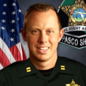
Captain Andrew Denbo has served over a decade with the Pasco Sheriff’s Office in the Tampa, Florida area, advancing from Deputy to Field Training Officer and Detective in the Active Crime Enforcement division. Promoted to Sergeant in 2018, he led patrol squads and the STAR (Street Crimes) Unit, playing a key role in dismantling criminal networks. Currently, as the Captain of Innovation and Readiness, Denbo leads the Apprehension, Reconnaissance, and Coordination (ARC) team and oversees the Unmanned Systems team, focusing on covert surveillance, fugitive tracking, and tactical mission planning, along with advancing the agency’s technological capabilities in drones and robotics. He has also commanded strike teams during Hurricane deployments and continues to drive innovation at the F1RST Campus, ensuring the agency is prepared for future challenges.
In this impactful webinar, Noreen Charlton of Skydio and Captain Andrew Denbo from the Pasco County Sheriff’s Office explore the life-saving potential of Drone as First Responder (DFR) technology. The session highlights a real-world case where drone technology was crucial in the swift rescue of a missing child.
Key Takeaways: Critical Case Overview: The webinar centers on a high-stakes search and rescue mission in which a missing child, hidden in a rural area, was located using a drone. Despite exhaustive efforts by ground and air units, it was the drone's thermal imaging and advanced navigation capabilities that ultimately led to the child's safe recovery.
Life-Saving Technology: The discussion underscores how drones can operate quietly, access difficult terrain, and provide real-time data, making them invaluable in urgent, life-saving missions. In this case, the drone's ability to detect heat signatures in dense terrain allowed officers to locate and rescue the child swiftly and safely.
Expanding Public Safety Capabilities: The webinar emphasizes how DFR technology enhances traditional public safety efforts, offering quicker, more effective responses in emergencies. The success of this mission illustrates the growing role of drones in life-saving operations, showcasing their potential to transform public safety strategies.
This webinar is a powerful testament to the effectiveness of drones in critical, time-sensitive missions, demonstrating their ability to save lives and improve public safety outcomes.
Noreen Charlton: Hey, everyone. Thanks for joining us today, and a big thank you to PoliceMag for hosting this webinar. My name is Noreen Charlton, and I lead public safety strategy at Skydio. I am very grateful today to be joined by Captain Denbo of the Pasco County Sheriff's Office. Captain, I'll pass it off to you for an introduction.
Captain Denbo: Yep. Good evening, everyone. I'm Captain Denbo. I'm over in Florida, so it’s a little bit later here. I’m with the Pasco Sheriff's Office in our Innovation and Readiness Division.
Noreen Charlton: Excellent. Do you want to give us a little bit of background on your career with Pasco?
Captain Denbo: Sure. Yeah. So, I've been with the agency for about fourteen years now. Over the last eight years or so, my focus has been on bringing the agency into the future.
For those who don't know the area, we're just north of Tampa. We’ve seen a lot of growth coming up from the Tampa Bay metropolitan area into our jurisdiction. Basically, where the city of Tampa ends is where we begin. So all those people living in the suburbs have kind of moved to our neighborhood. With this exponential growth in our population base, we’ve really been focusing on the future. The division I oversee, which is known as Innovation and Readiness, is really focused on all the different types of technologies, processes, and a global look at the agency—how do we get ready for what's next, from basic public safety responses to things like what we're here to talk about today, such as drones.
Noreen Charlton: Perfect. Appreciate that.
So I kind of just want to give the audience an idea of Pasco County and how it's set up. I know you mentioned Tampa, but just so everyone can kind of level set and see how their agency compares.
Captain Denbo: Sure. Pasco County's Sheriff's Office is the primary provider of law enforcement services in the jurisdiction. We serve roughly 640,000 citizens.
Anything north of the city of Tampa, until you get up further towards Brooksville, is pretty much ours. We have four municipalities within our jurisdiction that have their own police departments and city services. Within that area, as most of you from Florida may know, essentially, the sheriff's office is the only provider of law enforcement services. Florida also has the Florida Department of Law Enforcement, which handles some state-level work with cases that bridge multiple jurisdictions.
But generally speaking, anything from basic 911 calls to the most complex scenes is going to run through the sheriff's office. In terms of staffing, we have about 1,300 employees at the agency. Around 780 are sworn members. Additionally, we have a lot of the same types of specialty units that most jurisdictions of similar size would have.
We also handle a lot of the event planning and special events for the county. So we kind of dip into the emergency management side of the house, where some jurisdictions might have a separate Office of Emergency Management. We have a Sheriff's Office Emergency Management Division within our agency as well.
Noreen Charlton: Excellent. I know we're going to get more in detail about your drone program and where you started and where you are today, but can you speak a little bit to the manned aircraft that you have available to you in Pasco County?
Captain Denbo: Sure. Yeah. The sheriff's office makes use of government programs to acquire equipment, like most agencies do. We currently have six aircraft—two Huey helicopters and four OH-58 helicopters assigned to our aviation section.
These aircraft are primarily used for pursuits and scenes where we need to cover large areas. Our aviation unit has been around for decades, so it's nothing new for us. We're looking at ways to strategize when to use a helicopter versus other assets. Even with six helicopters, we often find that certain situations may only require one, like when we need a Bambi bucket for firefighting, which only attaches to the Hueys. The smaller OH-58s are more appropriate for certain search and rescue missions and patrol response scenarios. We use a variety of these aircraft and have eight pilots, a training pilot, and a chief pilot in that section.
Noreen Charlton: I think that your manned aircraft and the access that you have to air units and helicopters is pretty unique. A lot of agencies don’t have them at all, and some that do may only have a couple. So you do have a significant number of those. I think that plays interestingly into the development of your drone program and how you are using both of those as well, but we’ll get into that in a minute.
I do want to touch on this first. For those of you who aren't familiar, this is a very unique situation specific to Pasco County—Florida's Forensic Institute for Research Security and Tactics (FIRST). It’s a research and training facility that lives in your county, and it’s led by the sheriff's office. Can you speak a little bit about the overall training facility and what that means in Pasco?
Captain Denbo: Yeah. It is absolutely unique. What we've done here is something I think everybody in our individual areas has—a training center or some type of institution of higher learning offering law enforcement training in their jurisdictions.
In Pasco, the sheriff recognized a need for a center of excellence for many emerging disciplines, whether it be highly technical complex canine operations, what we're doing with drones, cybersecurity, leadership in general, and a few other disciplines like forensic science. So we set out to create a division of the sheriff's office focused on becoming a regional center of training for all these topics. We identified eight disciplines, one of them being unmanned systems and robotics.
The first facility, which is in Land O'Lakes, Florida, about 30 minutes north of Tampa, has a large campus where there's a building dedicated to each of these areas. For drones, we have a large indoor hangar with a shoot-house-type environment for practicing with robotics and drones. We also have a situational awareness room where all the drone footage feeds into, allowing us to run operations and tactical ops. For forensic science, we have a human remains field, which is several acres of wooded and swamp area containing donated human remains through an educational partnership with Florida Gulf Coast University.
We have other facilities as well. For example, our canine section has a 50-dog kennel where other agencies can bring and keep their dogs while they train at our facility. We also have some interesting resources for search and rescue, like two FEMA-rated rubble piles in our backyard. One simulates a collapsed disaster scenario, and the other simulates a collapsed parking structure with cars and other things smashed between layers of concrete. Everything is engineered to be reset and replayed over and over. FEMA teams come out and train here, as do many fire rescue teams from different regions.
In a nutshell, FIRST is, as you mentioned, the Florida Forensic Institute for Research, Security, and Tactics. It’s essentially just a division of the Pasco Sheriff's Office, with the idea that anybody in public safety can come out here, train, and make use of these resources. We've been able to do this as an agency by securing legislative appropriations or private donations, so local taxpayers haven't expended any money for the multi-million dollar campus we’ve built here. We also give back to the community—most of the buildings were constructed with inmate labor. Inmates from the jail, interested in bettering themselves and getting a job when they get out, participate in the construction process for eight to ten hours a day. They are compensated and go back in. When they complete their sentences, they are given opportunities to go directly to home builders or other employers looking to hire people with their skills.
Overall, it’s a great program with minimal impact on the budget, but it provides a great opportunity for public safety agencies of all types to come out and train and make use of some really cool resources.
Noreen Charlton: Yeah. For those watching, if you haven’t been there, I highly suggest you find a way to make a trip. It’s an amazing facility. If you're looking for drone training, check out the website and see what classes they have coming up—they do some great things there as well. Your whole setup is just phenomenal, right? You've got all these built-in scenarios out there that you can use, and I really think it's something people should check out if they haven’t already.
So getting into the history of the drone program for Pasco County, can you touch on how it all started? What prompted the idea of starting a drone program, and when did that come about?
Captain Denbo: Yeah. Sure. The drone program started, probably like most, as a SWAT need. Before we even conceptualized using drones for overwatch, search and rescue, or overhead-type situations, we were thinking about how they fit into searching buildings and using them in a tactical environment. About seven or eight years ago, we began by looking at different drones for interior use. We built some custom solutions with partners and were trying to figure out how to clear buildings with a drone on the inside.
That represented the start of the whole program.
At the time, there was debate—like many people have—about whether this should be within our special operations, like our aviation section, because they were piloting something. But we found that wasn’t really the case, especially since there weren’t all the regulations there are today, like Part 107 and licensing requirements. So we kept it within a tactical team that used drones. Then, about four or five years ago, we had a moment of realization: this was more than just searching buildings inside; there was a need to do what helicopters do. Not to replace helicopters permanently because, with our jurisdiction's size and layout, that’s unlikely. But we saw a need to offset some of the helicopter's usage. We fly thousands of hours per year, and if we could reduce that by a couple hundred hours with drones in the near future—and much more in the long term—we saw significant savings for our taxpayers. We also saw the potential to accomplish things better with the enhanced technology drones offer, which traditional aviation might not.
Noreen Charlton: Yeah. I think a lot of agencies start in that SWAT operations tactical use of drones, and some stay there for quite a while before realizing they can use different kinds of drones for patrol operations. So I don’t think your start is unlike most agencies. What’s different is the way you deploy drones tactically, and we’ll get to that shortly as well. But I love your use of multiple drones in SWAT operations. I also want to touch on a recent big win Pasco County had with a Part 107 waiver, which allows for remote operations of the Skydio X2 in a dock without a visual observer.
Can you speak to the process of obtaining that and what it means for your operations going forward?
Captain Denbo: Yeah. Absolutely. I failed to mention this during my introduction, but it’s important—we have over 700 square miles of jurisdiction. So, it’s not a small county.
With our traffic situation and population base, it could take an hour and twenty minutes to respond lights and siren from one end to the other on a good day, assuming there’s no traffic. We have a big mix of urban, suburban, and rural areas.
Most of it is suburban, but this creates an interesting challenge because, as things develop, nobody thinks about traffic and infrastructure. We have all these choke points around our county with constant delays. So we started looking at how we could get on the scene faster.
Obviously, the drone idea came up, and our first thought was to look at schools, right? When introducing drones, people sometimes have questions—what are they for? Are they going to protect people? Are they going to spy on people?
We get those questions all the time. So, we wanted to be clear about how we use them: to respond to public safety incidents. One of the most sensitive areas for that right now is obviously school safety. We have hundreds of schools within our jurisdiction.
We started identifying schools in areas with the most problems. We thought it would be great if we could pre-deploy drones there. But you can’t do that under the current FAA regulations without a waiver. So, we reached out to Skydio, and it was a very enjoyable experience to have Jakey there working with us. We provided a map of all the schools within our jurisdiction and what we were trying to do.
Step one of a broader remote-controlled drone program for us was to operate all the drones from a central command spot and then send them off to calls for service. The first phase of this model looks like what we’re doing at the schools. We like the schools for several reasons—if there’s one place we want to be when something goes wrong, it’s having eyes on the school immediately. Yes, we have school resource officers and all the other things everyone else has, but we want to be able to see what’s happening quickly if there’s a suspicious person on campus or another situation requiring quick response.
It made sense to take the waiver in that direction initially and figure out a way to get these docked drone solutions on campuses. Then, we could slowly expand from there as we demonstrate the safety case, proof of concept, and broaden out to other areas. That’s how we got started on it. Right now, I believe we’re one of the first, if not the first, public safety agencies to get this type of waiver under these conditions.
With Tampa International Airport nearby, it’s an ideal situation. Those who know understand it’s good to be near an airport—just not too close. The international airport has a 30-nautical-mile MOTSIE rail around it where people must transpond locations and such. It’s very helpful to have all the air traffic in a particular area transmitting their location, which helps us deconflict. I won’t get into the weeds, but that basically made the waiver much easier to obtain.
Noreen Charlton: Yeah. A couple of things—you were the first public safety agency to get this type of waiver, so congrats.
I know this topic comes up quite a bit, so if anyone has questions, please throw them in the chat. We will definitely get to them at the end.
You also bring up another great point. When we talk about Drone as First Responder or present to agencies about deploying drones from pre-positioned docks and getting them on the scene faster than patrol officers, one of the big questions is always, "Okay, where besides my patrol facilities or police department facilities can I place these docks?" We often say, "Fire stations are a great place to start. Use your fire partners." But also, schools are a brilliant place to start. As a parent and as someone who worked in law enforcement and crime scene in Las Vegas for a long time, I understand the importance of ensuring our kids are safe at school, right? Having those available close to schools is unmatched, and I think a lot of agencies don’t think about using those types of facilities. Building relationships within the county or city to use rooftops and get drones on the scene faster is crucial. I appreciate you sharing all of that.
Okay, I want to touch on some of the current use cases for your drone program. You mentioned that you started with tactical SWAT operations. Where did you move from there, and where does your drone program stand today?
Captain Denbo: Yeah. The next venture we made was with special events.
We have events like the county fair, various parades, and things that attract thousands or tens of thousands of people. We started thinking, okay, it’s cool when everyone sees the helicopter fly over at the parade, but then they get tired of hearing it. You know? They don't want to have to scream over it while trying to enjoy a festival or parade. So we thought, how can we use drones in these environments?
Florida has a unique legislative setup regarding the use of drones, particularly when you can and can’t use them. But one scenario when we can use them is when more than fifty people are gathered. We saw this as a great reason to have drones up and over a lot of events, like Christmas parades in small jurisdictions within our county. So we ventured into that initially.
Then, we slowly built into responding to in-progress calls, starting with the most severe cases—missing persons calls where hundreds of resources are deployed, or situations like standoffs where there’s a need to watch a backyard or side yard. We started a call-out team.
More recently, in the last couple of years, we've gotten to the point where we have well over twenty drones spread across patrol and other areas of the agency. These drones are geographically spread throughout the county so that members can respond to in-progress calls and deploy them in an emergency. It’s really grown—from just three or four guys having access to a drone for special events to a team of fifteen pilots with access to over twenty drones, ready to deploy from their vehicles and respond to calls for service as they come in.
Noreen Charlton: Patrol deployment is something many agencies would like to implement, but I feel like sometimes they hit roadblocks in finding personnel willing to say, "Yes, I want to be a pilot. I want to take on this extra duty," or just taking care of all the equipment and having it in their patrol vehicle for a response. Can you speak to how you may have had to break down some barriers to get people on board with wanting to be drone operators?
Captain Denbo: Yeah. It’s interesting. We recently conducted a survey asking our members what specialty units they wanted to join. Other than our fugitive apprehension group, this was actually the second most popular team.
We've been pretty fortunate. We’re a young agency, as I'm sure many others are. We're taking on a lot of new members and hiring forty to fifty people a quarter. We’re seeing a lot of younger generations interested in this type of technology.
That has been very helpful from the start. But to speak to your point, it is a logistical nightmare when you start talking about how you're going to deploy drones, particularly when you have over 700 square miles to cover. There are a lot of arguments. At first, through research, we’ve been digging in with other agencies about what they're doing and even teaching about it a little bit. But you have the problem of whether the officer on patrol is available to respond.
Maybe they’ve arrested someone and are en route to the jail, or they’re sitting with someone at a hospital. It’s a silly place to put a piece of equipment, right?
But at the same time, if you give it to detectives or someone more free to move around, they might work nine to five, and most of your calls come in during the afternoon. It’s complicated, to say the least. So, we’ve done a good hybrid.
We have some street crimes units often not assigned primary duties for calls for service but are more flexible. A lot of the members of our team are in those areas. We’ve identified other positions throughout the agency most likely to be available to respond to calls as they come in. The last thing we want is a valuable asset sitting in someone’s trunk or SUV while they’re needed elsewhere, but the person is stuck on a domestic disturbance and can’t leave.
We’ve tried to be thoughtful about that. It takes quite a bit, and there are so many factors. How many drones do you have? What is the distance? What are the shift structures like? We had to get creative and engage other entities, like partnerships, to ensure good coverage. I would say right now, about 80% of the times we ask for drones, patrol supervisors are empowered to ask that question on the radio. Then, one of our units will respond.
In that capacity, we only have three guys full-time in that unit. The rest are street crimes guys, detectives, patrol guys, etc. We’re able to hit almost every call-out using that structure. It’s been a learning experience. It is challenging, but it takes thought about where these people are and what their obligations are when they're out there.
Noreen Charlton: Do you find that officers or, as you mentioned, sergeants are more inclined to ask for aerial support with a drone than they were before with just the helicopters in your area unit?
Captain Denbo: Yeah. There’s a unique challenge with helicopters. We’re a wide county, and unfortunately, they planted our helicopter pad in, I believe, the foggiest place in Central Florida.
So what happens a lot of times is our helicopter unit might be grounded due to local weather conditions. In a larger jurisdiction, one of the benefits that may not be initially thought of is that it could be pouring rain in Land O'Lakes, Florida, but in Wesley Chapel or the New Tampa area, it’s sunny.
It’s probably the same everywhere, but there’s that running joke about Florida weather changing as soon as you turn around. We can have a drone pilot drive through a thunderstorm and launch their drone in an area where there isn’t that type of weather. So, with the strategic deployment of drones in particular areas, even if it’s raining on one coast or out on the beach, we have people inland who can launch the drones, and vice versa.
That’s been very helpful and has increased the frequency of requests. Secondly, it’s just educating the patrol group on what’s available to them because SWAT guys have a good handle on what we can do with drones, both interior and exterior, and those in specialty units are familiar. But we have hundreds of deputies on patrol and dozens of supervisors.
Getting them familiar has been key—getting with them at roll calls and educating them on what this technology is, what it can do, and how it can be used. There are many misconceptions out there—people think, "Oh, I can’t fly here," or "I can’t do this or that," or "This technology won’t help with this." But there are all kinds of use cases beyond just flying a drone.
You have mapping, perimeter holding, and many other things people don’t expect drones to be able to do.
Educating our guys on what they can ask for has been the biggest benefit in getting more requests. We now receive several requests per day for drones to respond to calls.
Noreen Charlton: You’re in a unique situation because you have access to an air unit, so most on patrol realize the benefit of aerial overwatch. It’s useful for setting up perimeters, calling out street names, and figuring out where people need to go.
But agencies without access to an air unit may need to think more outside the box about how beneficial it would be and how important it is to have that aerial overwatch on many calls where they normally haven’t had it. Drones can fill that gap for those agencies. There’s also a piece to drones that people don’t always think of—these drones can fly low and close to objects, so you’re not stuck with just an aerial overview of a scene. You can use them to get down low. Many agencies use them to fly under tree lines or canopies in search and rescue missions, or to clear a vehicle by looking through windows before officers approach.
There are many different things you can do with drones, and as you said, it’s about thinking creatively and educating everyone to let them know, "Hey, we’re here. We have the drones. Call us out. We can use them on a lot of different scenes."
I also want to speak to you about something interesting we discussed earlier—your unique way of deploying drones on SWAT operations. Can you touch on that for a bit?
Captain Denbo: Yeah. Absolutely.
With all our tactical operations, we probably go a little overboard on planning, which I think is a good thing—you can never really overplan. Essentially, we have many investigative units and divisions within our agency that generate search warrants.
Part of the approval process for getting a search warrant served, I don’t know how some other agencies do it, but here, you must come and present your search warrant to our leadership and say, "Hey, this is what I'd like to do. I’d like to hit this house at this date and time." Part of that process involves what we call a "threat assessment meeting," where SWAT leadership, myself, and other members of the agency sit in a room.
One of the immediate denial factors is, "Did you get the proper drone language in the search warrant?" Florida has a specific requirement for this. It’s easy to do, but it must be in there. Our tactical leadership has basically said, "If you want SWAT and us to come out and do anything, there will be a drone on the scene." Setting that bar right there is helpful.
We’ll tell the investigative unit, "Hey, you’re going to have to come back and add that language in there if you want us to do this." The model is unique. The first thing we do is go out ahead of time and map out the area where the operation will occur. We do this to the best of our ability within the law to ensure it’s a good map, close enough to see what we need but not too close to alert people about a potential search warrant.
Then, we map it out, bring it back, and give these maps and pictures to our tactical planners and SWAT section to understand what obstacles they might encounter. Google Maps is great until you show up with the Bearcat and your team, and there's a fence in front of you that wasn’t there, or maybe on the other side of a fence you thought was just wooden, there’s a collection of debris that might pose a hazard to your SWAT guys or whatnot.
So we always try to get all those things done ahead of time. Once the operation actually unfolds, that’s when it gets crowded with the drone space. We have an Overwatch drone that comes on target right as our tactical team rolls up. We have micro and macro view drones.
These are all Skydio X10 drones with different roles. The one with the overview streams back to a forward command post where our SWAT leadership and I are positioned.
That gives us good situational awareness—what are we rolling into? Is anybody running? Is anything developing in the last few seconds? We have ground surveillance guys with a good street view, but this gives us an overhead view if someone takes off out the back as we roll out. The macro view gives us a wide-angle view. Sometimes we don’t have that, but if there’s a neighboring house related to the investigation, we’ll keep a view on both properties to see if anything happens and requires a response.
We also look for friendlies, things like that. The micro view is the chase drone. If someone takes off running out back, nine times out of ten, the SWAT guys will go after that person. But sometimes, due to terrain or environmental complexities, they can’t. So, what we’ve done several times is hold the position of that person and relay updates over the radio to the K-9, guiding them right to where they need to go to challenge and detain that person.
We’ve also had vehicles leave just before our SWAT team rolls up—maybe they hear something coming. We’ll visually follow that drone as it drives through the neighborhood, and then our undercover units can conduct a traffic stop or something like that on the vehicle. It’s a great tool. We have all three in the air. For interior operations, we use interior drones and a robotic dog from Boston Dynamics to do interior searches.
Realistically, there could be four or five drones per search warrant we execute. For reactive call-outs of our tactical team, it’s the same thing, minus the planning portion. If we have any kind of barricaded person, we send that same package there.
SWAT call-outs have increased due to efforts to negotiate and resolve things peacefully.
We’ve spent dozens of hours before flying drones nonstop, covering situations where it’s smarter to have a drone perched behind a house than to have a tactical operator standing in the Florida heat for several hours. In certain situations, letting those guys catch a little shade is appropriate. We’ve been able to hold that, and it makes things great at the command post. Speaking of the command post, things that aren’t really visible can impact decisions. With drone pilots seeing what’s going on and streaming it back to the command post, commanders can make better decisions about asset deployment on the scene.
Noreen Charlton: I think even your example about saving one person from standing in the backyard in the Florida heat for several hours is a great one. When I worked in Las Vegas, we had several barricades that lasted days.
Beyond just the safety aspect, being able to say, "Hey, we can take those people out of the backyard because now we have Overwatch with the drone. We can see what’s happening back there without having someone physically there," is appreciated. People appreciate that, right? It’s a great example of using drones in different ways to get what you need and minimize the personnel on the scene and on the front lines.
Your setup for using drones in those operations is a perfect segue into the case study we are discussing today, which is about a missing child. Can you give us a little background, and then we’ll talk specifically about how you used drones in this case?
Captain Denbo: Yeah. Absolutely. This case involved a child missing from another state.
Federal agencies were involved, and we were looking at potential locations where this juvenile might have been with the person we believed they were with. As this unfolded, there came a time when some intel was gathered that they might be at a particular house.
Members of the US Marshals units descended upon this house, trying to recover the missing child.
As they did, the suspects fled the house just before everyone’s arrival. In this situation, when they fled, the marshals and everyone got on the radio and said, "Hey, look, this person just took off." We were advised by the neighbor they ran out as we were coming down the street. They didn’t have eyes on anybody, so they called in K-9 and aviation assets and things like that.
So, yeah, all those assets initially responded and got there.
About that time, a neighbor said, "Hey, I think they ran across the street," and it’s kind of a rural area of our county, so there’s not a whole lot out there. We felt we had good odds of locking the area down. We dispatched about forty to fifty officers and set up a large perimeter around the area at that point.
Noreen Charlton: Great. We’re going to switch over to a video. If you could briefly discuss what we’re seeing in this video, and then we’ll talk about how long you had the drones up and what you did with them.
Captain Denbo: Perfect.
In this video, what you’ll see is the ending.
Going back a bit, we had our aviation unit and patrol units on the scene for quite some time, but unfortunately, they were unable to locate the subject they were looking for until the very end. What happened is one of our drone pilots was deployed at about the one-hour mark. We started looking for thermal signatures since it was one of the few cold days in Florida.
The pilot first saw a small heat signature in the woods that didn’t make sense—it didn’t belong there. They zoomed in and got a better look to see what was going on. They realized it was actually the feet of the missing juvenile, who was lying on the ground, and the person with her was lying over her.
They then switched to a color camera and confirmed the color of the pants was purple—something quite unique—and we were able to confirm it was who we were looking for. The pilot then used the drone’s mapping features to direct units to the child’s location.
In the video, you see the K-9 teams and various undercover units rolling up on the scene. The drone pilot is in communication with them, guiding them forward—"Okay, turn right"—just like your aviation unit would do, guiding those units right to where they needed to go. A big takeaway from this is that—and this isn’t a knock on our aviation unit because they do a great job; I think we have some of the best pilots in the area—but due to equipment limitations, some of the angles and approaches they were using on the scene didn’t allow them to see what we were able to see in this drone footage. We were only about 150 to 200 feet off the ground, maybe 200 to 300 feet away.
Another factor that often comes up is that helicopter circling can cause people to hunker down and hide. They’re not trying to poke their heads out to see what the helicopter’s doing. But once that helicopter leaves, we’ve found that the drone is such a quiet resource that people don’t think anything is still looking for them.
So they might poke their heads out or get more relaxed than they were while hiding. We think that may have happened in this case, where the person with the missing juvenile thought they were okay and allowed her to come out from under the woodpile a little. When the helicopter leaves, they have this sense of security—"Hey, that thing looking for me is gone." But what they don’t know is that something of similar resolution and quality is still looking right at them, and that’s how we were able to guide our guys to recover this girl.
Noreen Charlton: Excellent.
You mentioned earlier about live streaming.
In a situation like this, what are you using to live stream this information back to command staff or anyone else who needs to see it beyond just the drone pilot?
Captain Denbo: Yeah. We do a couple of things. We’re very fortunate with equipment.
We have the ability to use the Skydio Cloud service for streaming as a primary option. As a secondary, we have access to LiveView to stream the drones back. But we believe it’s almost irrelevant to have only the drone pilot see what the drone is seeing, right?
It doesn’t offer much when the person flying the drone is the only one who knows what’s going on. We’ve made it mandatory for our guys to stream whenever they’re on something. We’ve created a system through the new ReadyLink that you guys offer, allowing us to have one link that command staff and leadership know they can go to, no matter which of our twenty-plus drones is flying, to see what’s happening live. We’re training supervisors and patrol officers to use that to their advantage so they can see what’s happening live and move their units appropriately.
Right now, we’re using both—the Skydio Cloud and LiveView.
Noreen Charlton: Yeah. I think that’s pretty common. There’s this concern that if an agency brings drones into their toolkit, it’ll be difficult to integrate with their current systems. There’s also a misconception that you need a massive RTCC with all these computers and TVs. The reality is, you don’t.
You mentioned ReadyLink, which Skydio created to make it easy to share your live stream with anyone you want to have access. Whether it’s generating a QR code you can show someone on your phone—"Scan this, and now you have access to the drone view"—or generating a link you can put in a browser, the best part is that it doesn’t have to be specific to your agency.
It’s not like every single person in your agency has to go to Skydio Cloud, log in, and have a username and password. They just need the link, and they can choose the drone feed they want to view. Beyond that, agencies often work with other agencies and have task forces. Before easily sharing live streams, it was difficult to get the information you had to someone in a different agency, and a lot got lost in communication or the game of telephone passing that information along.
Now, anyone part of the investigation can have access to that drone stream as long as they have the ReadyLink. I appreciate your input on integrations and the live stream.
We have some questions popping up in the chat, and I want to make sure I get to those before we wrap up.
Anything else you want to add on this case study or lessons learned, or anything important for the attendees to hear?
Captain Denbo: No. Nothing specific. I think you hit the nail on the head with the communication aspect.
Again, if you want to sell the administration of your agency on the use of these things, you have to be able to show them what they’re doing. And not a week after you did it when you upload a video somewhere—it’s when it’s happening. That’s when they see the value in it.
We’ve seen a huge return on investment for us regarding our ability to respond and get to places quickly. We’re excited about what the future brings in terms of remote drones, first responder operations, and things like that. Nothing specific, but looking forward to the questions.
Noreen Charlton: Yeah. I'm going to get to those in a second. I have a quick plug for everyone attending. Skydio's conference is coming up near the end of September—September 25th and 26th. We will highlight what people are doing with drones in many industries, from defense to utilities to public safety, with a big focus on public safety and Drone as First Responder.
We encourage you to join our keynotes to see what’s new in the world of drones for law enforcement. We’ll also be live streaming some of our breakout sessions, so, similar to today, you can hear how other agencies are using drones, the struggles they’ve encountered while building their programs, and the success they’ve seen since implementing them. Just wanted to throw that out real quick. Now, I’ll jump into the questions.
The first one is: How would you train on decreasing response time with drones?
Captain Denbo: I think I know what you’re asking. As far as strategy—making sure the drones are there quickly—we’ve done some deep dives into where calls for service occur that require drones. Again, Florida's a unique environment where we have a statute dictating when we can and can’t use drones.
Against the backdrop of all the calls for service we go to, we strategized which units and areas would have these drones based on who is most likely to be in the area of these specific call types. The obvious ones are missing persons, but there are other call types. You can also go through historical data where, if you have an air unit or rely on a neighboring agency’s air unit, see where they responded most frequently.
We tried to be thoughtful about where we place those drones concerning where the calls are most likely. Sounds silly, but some of our detectives drive cars with just two lights because they work in major crimes or something like that. That’s not helpful for responding lights and siren with a drone somewhere. So, we prioritize marked patrol cars that can respond quickly to calls over special units with less obvious vehicles not as safe to respond with lights and siren to calls.
I don’t know if that answered the question, but the strategy behind what geographic areas we place drones in and how to get them there the quickest has been on that. If you’re talking about docked drones, the same thing applies. We did a dive with some help from Skydio on two years or so of call-for-service data to see where those types of calls were coming in. Then, we started thinking about property we had access to owned by us or government entities in the area.
Something pretty obvious is fire stations, right? They spend a lot of money figuring out where fire stations need to be to respond to calls for service, geographically centering them so response times can be low when there’s an emergency. There was a high level of correlation between where fire stations are and the density of those stations and where we think we want to put drones in the future for dock solutions.
Noreen Charlton: When it comes to dock-based DFR and having drones autonomously fly to calls for service, whether from a 911 call, I think as soon as the call comes in, the drone goes to that GPS location, or it's triggered by something like ShotSpotter gunshot detection or automated license plate readers.
Choosing spots for those docks is heavily based on hot spots and higher crime areas. Yes, we look at calls for service and all that information. We can determine, based on where you get the most calls, the best place to put your docks to respond to those calls—from the call coming in to the drone being unseen in under two minutes. A lot goes into that.
But I think you hit the nail on the head for the person who asked that. If there’s more you need to know, just drop it in the chat, and I’ll try to get to it.
Another question is: Other than a class, what are other or better ways to inform your department on when and how to ask for a drone or use them on the scene?
Captain Denbo: It’s kind of like a traveling roadshow we do. I oversee several units besides the drone unit. It is one of the bigger projects I have. But we go around every six months or so, hitting every roll call and saying, "Hey, look, this is what we’re currently doing. This is what we can do." We make sure to share success stories because we find that’s the most useful thing. If you send someone a PowerPoint, a memo, or a posting, I’m sure it’s the same everywhere—they’ll look at it as much as they have to, then delete the email and forget about it.
But if we come out and share success stories with officers and deputies, letting them see what’s happening, they’re much more likely to ask for it next time something happens. That’s been our biggest push.
As for when they can, that’s more of a legal issue. We’ve been driving that home with supervisory positions, about when they can and can’t use a drone.
We’ve empowered our drone operators to say no. The answer is always yes—we’ll figure something out. But it may not be a drone, right? If the law doesn’t permit it, or if safety conditions aren’t right.
A lot of agencies may have a captain or someone on the scene at a big incident wanting a drone up, but then there’s an officer or deputy thinking, "I don’t know if I should be doing this." The clear answer from our agency is that the person flying the drone makes that decision.
They’re well-educated, and our chain of command overseeing the drone unit backs them up. They know when to say yes and when to say no. But by and large, it’s yes almost every time. We find a way to make it work, and yeah, it’s been very good.
Noreen Charlton: Perfect. How do you train on communicating from the drone operator to the officer and vice versa?
Captain Denbo: That’s a great point because it’s a hard one. I think even agencies with large air units, with planes or helicopters, have this problem.
One benefit we see is if the pilot is a deputy patrolling an area, they already know how their squad works and regularly communicate with them, so that helps. But one thing we do at the FIRST campus in Land O'Lakes is monthly training with us and a lot of surrounding agencies. I won’t throw them out there, but all the Tampa Bay region agencies send people to our place periodically. So, every month, for at least eight hours, we bring everyone out.
We train on scenarios. We might do thirty minutes of classroom training, but the remaining seven hours are scenario-based training outdoors or indoors in our drone hangar facility. We run drills on that—setting up perimeters where we’ll have actors take off running, make people follow them, give descriptions, and things like that.
Repetition has been the best way. Also, making them aware that they’re not just silent observers looking at the controller and what’s happening. They need to be able to say, "Hey, the perimeter is weak on the north side. We need someone over there," or "Hey, I can’t see this area. Can we get eyes on that from the ground?"
Just getting them focused on the ability to offer guidance to the incident commander at a scene has been key, making sure they feel comfortable in that role.
Noreen Charlton: Perfect. Let’s see. Is there somewhere to look up different types of scenarios for implementing with SWAT and patrol?
Captain Denbo: That is a good question. I’m not sure.
I guess I could plug FIRST—you can come out and train with us. I don’t know. The main scenarios we run into are that any SWAT scenario we call out, we’ll send drones to. For us, it’s almost anything.
We’d rather have the asset there and not need it than need it and not have it.
Noreen Charlton: Yeah.
Agencies are finding more and more incidents where they’re using drones. Some of it just turns into, "Hey, let’s just put the drone up and see if this is helpful." Then, they realize it was a success, and they start using it on those types of calls all the time. For example, agencies not yet using drones via a dock are deploying them to the last known location from an automated license plate reader, just getting the drone up to search the area because it’s easier to look from above than for units on the ground.
Burglaries in progress, anything outdoors where someone might have a weapon—getting the drone there first to set up your tactical operations and plan your approach before rushing in blindly. There are many scenarios where drones can be used in patrol.
There are resources out there. At Skydio, I work with many customers sharing their stories and successes. The stories are out there—you just have to look. You can always email us, and I can point you to more resources.
Let’s see here. When having—well, I’m not sure—I think we touched on this, and you guys have some docks as well. But when having drones docked, how do you identify the places to place them if you’re not choosing the station?
Captain Denbo: Yeah. I think we hit on that. It’s data-driven.
We’re most comfortable with those things being placed in government-owned facilities we can access perpetually, without worrying about someone changing their mind, like a business partnership with a new owner who might not want to play ball anymore.
So, yeah, for us, it’s going to be fire stations, schools, and other publicly owned buildings and properties.
Noreen Charlton: I think that’s the best way to go. Get with your city, your county, and start conversations about other buildings owned by the city and county. Figure out what’s in a good location for connectivity and close to hot spots for crime, and work from there.
This question is about public records specific to Florida.
How does all of this work within records law? Is it real-time access, or are you just doing recordings?
Are drone videos used for retrieval by the public?
Captain Denbo: Great question. Florida has a broad public records law, known as the Government in the Sunshine Act. Anything we record is obviously subject to disclosure.
We treat drones like we do body cameras. We have about 800 body cameras in the field, so it’s not new for us to manage public access to video when requested. We have a bridge between evidence.com, our provider for most of our non-tangible evidence, and the Skydio platform.
Videos we need are uploaded there, and our records division manages that. There are some unique Florida statutes regarding exemptions from public disclosure, like interiors of houses, depending on the circumstances. If it’s active criminal intelligence, we don’t release it. But generally, if it’s not exempt, we’re happy to provide it.
There’s a small cost for the redaction process and other legally allowed charges when people request those things. But we keep all videos within statutory requirements, and people can contact the sheriff’s office to get records. For live access, we don’t do anything like that.
We maintain records of flights—when and where they occurred. These are also subject to exemptions if something’s active or ongoing, but logs and such are available for public disclosure for those with questions.
Noreen Charlton: Yeah. That’s a great answer. We have many agencies that have built out a transparency dashboard logging and making public their flights. If someone goes outside and sees a drone overhead and isn’t sure, they can go to that website and see, "Yes, the police responded to this general location on this date and time." There usually aren’t any details about the incident, just that it was a police drone in the area.
We have a couple of minutes left. How often do you train? And someone’s looking for information about the FIRST facility.
Captain Denbo: Sure. The training question is—it’s as much as we can, but by policy, we train a minimum of eight hours per month with all our pilots.
I didn’t get into it too much, but we’re forming a partnership with our local municipalities, fire rescue, and emergency management, intending for the sheriff’s office to lead a task force where all the individual municipalities purchase drones from the same provider. We host the training. That way, if a local police department or fire department uses a drone, everything works together. We intend to take that to a higher level.
Right now, we’re spending eight to fourteen hours a month training with drones. We do this both at our campus and remotely at pre-planned locations, simulating scenarios with dummies in the woods or with K-9s training, where we jump in and track them—things like that.
As for FIRST, if people are interested, it’s floridasfirst.org.
They can go there and access everything they want to know. We have many classes on drones and other topics. We’re happy to have people out there. It’s floridasfirst.org.
Noreen Charlton: Excellent. I’m going to hit you with one more before we wrap this up. What advice would you give a department considering starting a drone program?
Captain Denbo: I would say it’s a great idea no matter your size. I’ve worked with everybody from up north, like NYPD, to smaller departments. Everyone has a slightly different answer on how they got started, but they’re all happy with the results. I’ve never met anyone who regrets it. I’ve been all around the country talking to people as we got started, and I stay in contact with most of them. Nobody regrets it.
The best advice I would give is to think thoughtfully about how you incorporate drones, particularly for law enforcement. Your aviation unit, if you have one, must be engaged because they’re good pilots. They know what they’re doing.
There’s always going to be a natural pushback or skepticism from a pilot who runs a manned asset. They’ll say, "If I make a mistake, my life’s in danger. If you make a mistake, a piece of equipment might fall." So, you have to think about and understand that as a drone pilot.
Manned aviation has had years to perfect safety, and there are many regulations for good reasons. Make sure the people you choose for drone pilot positions understand the hierarchy of risk in airspace and know they’re not at the top—the manned assets are more important, and we need to keep them safe. Choose a drone platform that prioritizes safety. Obstacle avoidance is huge for us. We don’t like crashing drones—it’s not economically responsible.
Some drone features, like obstacle avoidance and the ability to stream, are huge. Ask a lot of questions before buying. All these little things are great, but you might assume they work. Maybe you had a consumer drone at home that did great things, but then you buy one from a different company, and it doesn’t do those things.
Ask those questions upfront and make sure you understand what you’re getting into.
By and large, the most important thing is to look at the data, figure out where drones need to go, and who has them. That’s where most mistakes are made. If you put all the drones in one division or area that’s not outward-facing or responding to calls for service, you’ll miss many opportunities where drones could help. So, in our opinion, start at the patrol level, identify key players for dispatching drones, and slowly evolve to more refined tactical operations. That would be my advice.
Noreen Charlton: Nailed it. That was perfect.
Alright. We are at the top of the hour. Thank you so much for joining me today. You’ve provided a wealth of information about your program, the use cases, and the success you’re seeing. I appreciate your time.
For everyone else, thank you for listening and for the questions.
If you need anything, both of our email addresses are on the screen. If there’s nothing else, thanks again, Captain Denbo, and we’ll catch you on the next one. Thanks, everyone. Stay safe.
Captain Denbo: Thank you.