
Optimizing Inspection of the O’Callaghan-Tillman Bridge


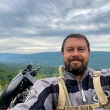
You could say flying is in his blood. Michael grew up flying with his dad, a recreational pilot. By pairing a love of soaring and passion for video games, he’s become a key player on our bridge, tunnel, and infrastructure inspection team as a certified Part 107 pilot for unmanned aerial vehicles (UAVs). As Bridge Inspection team lead and UAV practice lead, he serves a dual purpose as the pilot-in-command and engineer for inspection and condition assessment projects.
Michael has fostered relationships with key partners in the industry to capitalize on the benefits of 3D object avoidance and automated flight. Using this technology, our bridge group deploys UAVs to inspect areas on a structure where conventional inspection methods previously made it impossible.
Inspecting critical infrastructure in our communities for safety is crucial. A favorite moment for Michael is when he was performing a routine bridge inspection in a rural community and a resident stopped to say thank you for keeping their bridge safe. At the end of the day, that’s what it’s all about.

Joshua has 20 years of experience managing a wide range of environmental, exploration, and geotechnical projects and currently is serving as a reality capture technology manager.
Joshua has a diverse knowledge of geo-environmental consulting including site assessment, compliance reporting, regulatory negotiation, feasibility studies, stormwater compliance, soil/groundwater remediation, and aerial data acquisition. Specifically, he has performed soil and groundwater assessments and monitoring, and CAP placement for railroad sites, implemented and operated groundwater remediation systems, planned environmental assessment and remedial efforts providing cost-effective solutions to environmental problems, and achieve regulatory closure. Joshua also has coordinated staff, procured equipment and materials, directed subcontractors, and managed budgets to achieve successful environmental site closures and ultimate client satisfaction. Joshua has experience composing and reviewing technical documents, including work plans, site assessments, remedial action work plans, risk assessments, and final reports for regulatory compliance as well as utilizing unmanned aerial system (UAS) to deliver aerial orthomoasics, digital terrain models, watershed analysis, volumetric calculations, aerial inspection, facade analysis and 3-D models.


I am a Photogrammetry and Mapping Expert. I have been working for the last 11 years training and supporting professionals to successfully integrate Drone Photogrammetry and Mapping data in their workflows. I am experienced in different industries such as Mining, O&G, Surveying, and AEC.
I am a Photogrammetry and Mapping Expert. I have been working for the last 11 years training and supporting professionals to successfully integrate Drone Photogrammetry and Mapping data in their workflows. I am experienced in different industries such as Mining, O&G, Surveying, and AEC.
In this live talk, Michael Marshall, Bridge Engineer and UAS Program Lead, shares how Stantec is using Skydio to create new bridge inspection workflows that cut inspection times and crews by up to 75 percent vs traditional methods. These new inspection workflows also result in more valuable data, driving operational value for the business.
Traditional bridge inspection methods are inherently slow, risky, and come with high costs. Stantec, a leading engineering and inspection firm, estimates that bridge inspection time (and personnel) can be reduced by up to 50 percent by utilizing drones. Bridge inspections can require rappelling efforts and expensive equipment—just to locate issues, let alone fix them— which slows or stops traffic and puts personnel in potentially dangerous situations adding to the already high costs.
In this live talk, Michael Marshall, Bridge Engineer and UAS Program Lead, shares how Stantec is using Skydio to create new bridge inspection workflows that cut inspection times and crews by up to 75 percent vs traditional methods. These new inspection workflows also result in more valuable data, driving operational value for the business.
Watch this recorded live talk to walk through the new workflows and see firsthand results from an inspection conducted on the Mike O’Callaghan-Pat Tillman Bridge.
Watch the talk to:
- Understand why over half of state transportation agencies are adopting these workflows
- Walkthrough an actual bridge inspection and understand how simple it is to capture inspection data and locate critical issues
- See how to gain insights quickly, improve accuracy, and reduce the number of resources necessary for regular inspections
- Learn how inspection times are reduced from over a week to just days, freeing up key equipment and personnel for more critical work
- Gather insights into real cost-savings, and understand the positive impacts on your budget